
SkymatiX, Inc.

【Satellite image】
~Annotations of complex and highly difficult satellite images were also highly rated.~
The delivered data was of top-level quality compared to other vendors. The biggest point is that you were able to create good annotation data without requiring much effort on our part.
Yazaki’s image annotation service leverages its expertise to address these challenges and deliver high-quality data.
✔ Low image resolution requires frequent zooming, making annotation time-consuming.
✔ Working while zooming and scrolling increases the risk of overlooking target objects.
✔ Comparing multiple images to make judgments is labor-intensive.
By outsourcing your annotation work, you can focus on the tasks you should be prioritizing, such as AI model development and validation.

.png)
Annotators with expertise in satellite imagery
Experienced annotators with extensive expertise in satellite imagery handle every project.
Other Features:
・A comprehensive security system developed through experience in automotive parts manufacturing
・A quality control system that minimizes errors through 100% inspection and other measures

No upfront costs, plus a free trial available
For first-time customers, we also offer the “Satellite Image Special Plan,” which provides annotation services for small volumes at a special rate.
Other Features:
・We provide proposals based on your budget and schedule
・We can tailor proposals to fit your budget by adjusting the number of polygons used for area extraction, among other methods

Compatible with tools for satellite imagery
We use annotation tools suitable for QGIS, low-resolution satellite imagery, SAR imagery, and similar data.
Other features:
・Extensive experience with annotation based on comparisons of multiple images
・Handling ambiguous requirements and exceptional cases by creating QA lists, among other methods
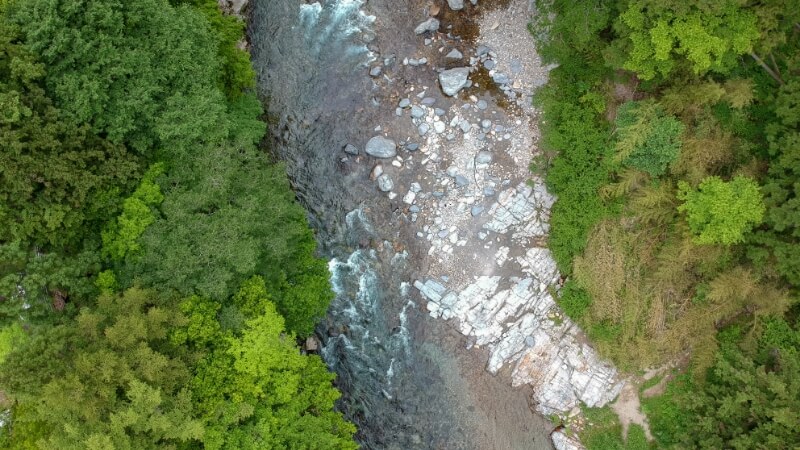
River boundary
- Extraction of the boundary area between the river and shore.
-
Carefully apply polygons to features such as sandbanks and river meanders by enlarging the image.
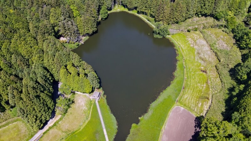
Classification of grassland and trees
-
Classification of geographical characteristics such as grassland, trees, farmland, gravel, etc.
-
Expert Yazaki employee annotators carefully handle natural objects with complex shapes and variations.
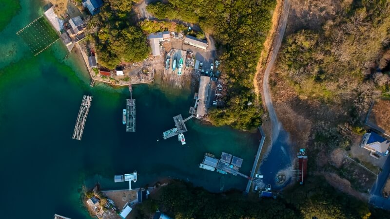
Shadow
- Ship Shadow Object Detection
-
Combine multiple perspectives, such as comparing SAR images and optical images

Verify Quality in Advance

Reliable Cost Estimates

Requirements Definition Support
Requirements Discussion

We discuss your AI development project and annotation requirements.
Trial

We offer a free trial. (An NDA can be signed if required.) Experience YAZAKI quality firsthand.
Quotation
After confirming the requirements, delivery format, and schedule, we will provide a quotation.
Contract Signing

We execute the agreement based on a master service agreement and a purchase order (including the project amount).
Annotation

Once the detailed requirements are finalized, we begin the annotation work. We use a Q&A process to prevent misunderstandings.
Delivery & Acceptance

We deliver data that has passed our internal quality inspection.